Maps and Directions to RTMC
San Bernardino Vicinity Map

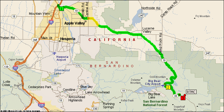
Victorville Vicinity Map

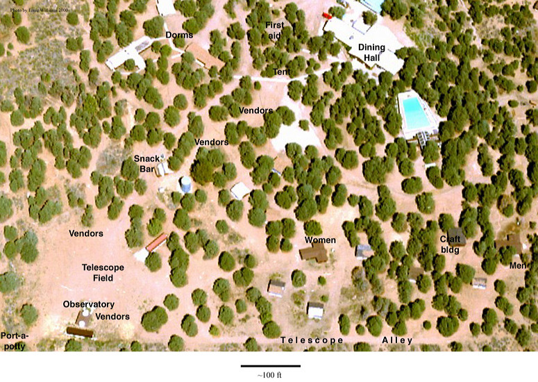
Aerial View of Camp Oakes

Directions
From the west
Exit Interstate 10 at State Route 38 in Redlands (also called Orange St., labeled #1 on the map). Turn left onto Orange Street and go north 0.5 mile to Lugonia Avenue, which is marked as the continuation of State Route 38. Turn right onto Lugonia Avenue and go east 43 miles on State Route 38, past Angelus Oaks, Barton Flats, and Onyx Summit to Lake Williams Drive. Lake Williams Drive is about five miles northwest of Onyx Summit and located between mileposts 44 and 45 on State Route 38. Turn right onto Lake Williams Drive and follow the signs to the RTMC Astronomy Expo.
From the east
Exit Interstate 10 at Oak Glen Road in Yucaipa (labeled #3 on the map). Turn right onto Oak Glen Road and go northeast 4.3 miles to Bryant Street. Turn left onto Bryant Street and go north 2.4 miles to State Route 38. Turn right onto State Route 38 and go east 35 miles, past Angelus Oaks, Barton Flats, and Onyx Summit to Lake Williams Drive. Lake Williams Drive is about five miles northwest of Onyx Summit and located between mileposts 44 and 45 on State Route 38. Turn right onto Lake Williams Drive and follow the signs to the RTMC Astronomy Expo.
From the north
Exit Interstate 15 at State Route 18 in Victorville (labeled #1 on the Victorville Vicinity map). Turn right onto State Route 18 and go south 42 miles to Greenway Drive in Big Bear City, which is the continuation of State Route 18 (labeled #2 on the Big Bear City map). Turn left onto Greenway Drive (State Route 18) and go south 0.7 miles to State Route 38 (Big Bear Boulevard, labeled #3 on the Big Bear City map). Turn left onto State Route 38 and go southeast 5.3 miles to Lake Williams Drive, located between mileposts 44 and 45. Turn left onto Lake Williams Drive and follow the signs to the RTMC Astronomy Expo.
